Towns That Would Need 3D Maps: Setenil de las Bodegas and Ronda - Béla Soltész's travel reports
Unexpected sights in Andalusia: Béla Soltész's travel reports
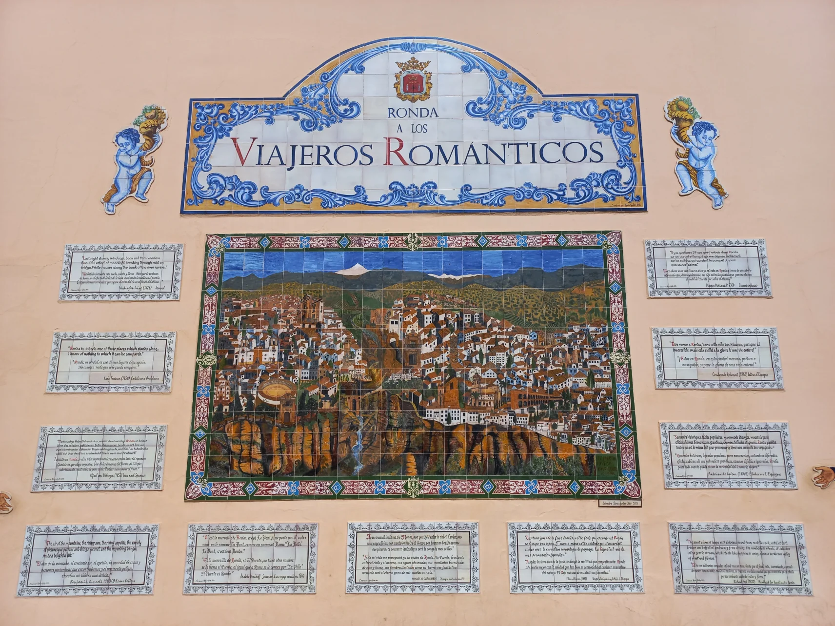
Béla Soltész is a writer and social researcher living in Budapest, Hungary. In August 2022, he participated in Travel Factory Andalucía's trips and wrote about his experiences in a four-part travel report. Read about Nerja, Frigiliana, El Acebuchal, the Río Chillar gorge, Setenil de Las Bodegas, Ronda, Comares and the Karma Guen stupa through the eyes of a seasoned backpacker!
Chapter III: Towns That Would Need 3D Maps: Setenil de las Bodegas and Ronda
I come from a fairly flat country. Perhaps that is why I am fascinated by places where the topography gives a third dimension to the network of streets. I love rises, slopes, stairs, houses and terraces that extend below and above each other: surreal landscapes to be found in M. C. Escher's pictures. I was lucky enough to visit two cities that could have well been drawn by the famous Dutch graphic artist: Setenil de las Bodegas and Ronda. The first is a small town where the streets wind almost underground – or at least under the jutting stone ledges. The other is a larger city that rises dramatically above the surrounding plain and impressively connects its two districts with a 18th-century viaduct built over a chasm.
Public transport is not very good in this area, so starting from Málaga, we could probably only see one of the two towns in one day. However, with our tour guide Manu, we visited both, and our city visit turned into a super road trip. In the case of both Setenil and Ronda, he professionally guided us up and down stairs and inclines to the places from which we could best experience the incomparable atmosphere of these two strange, three-dimensional cities.
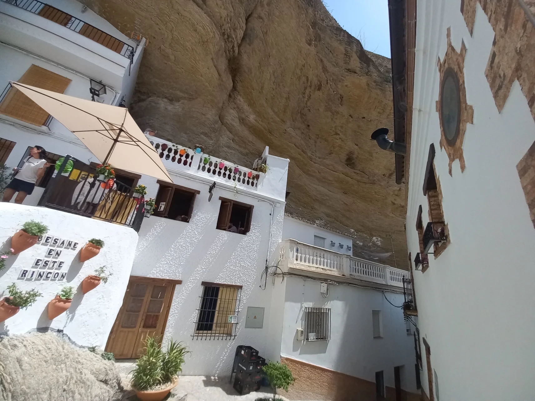
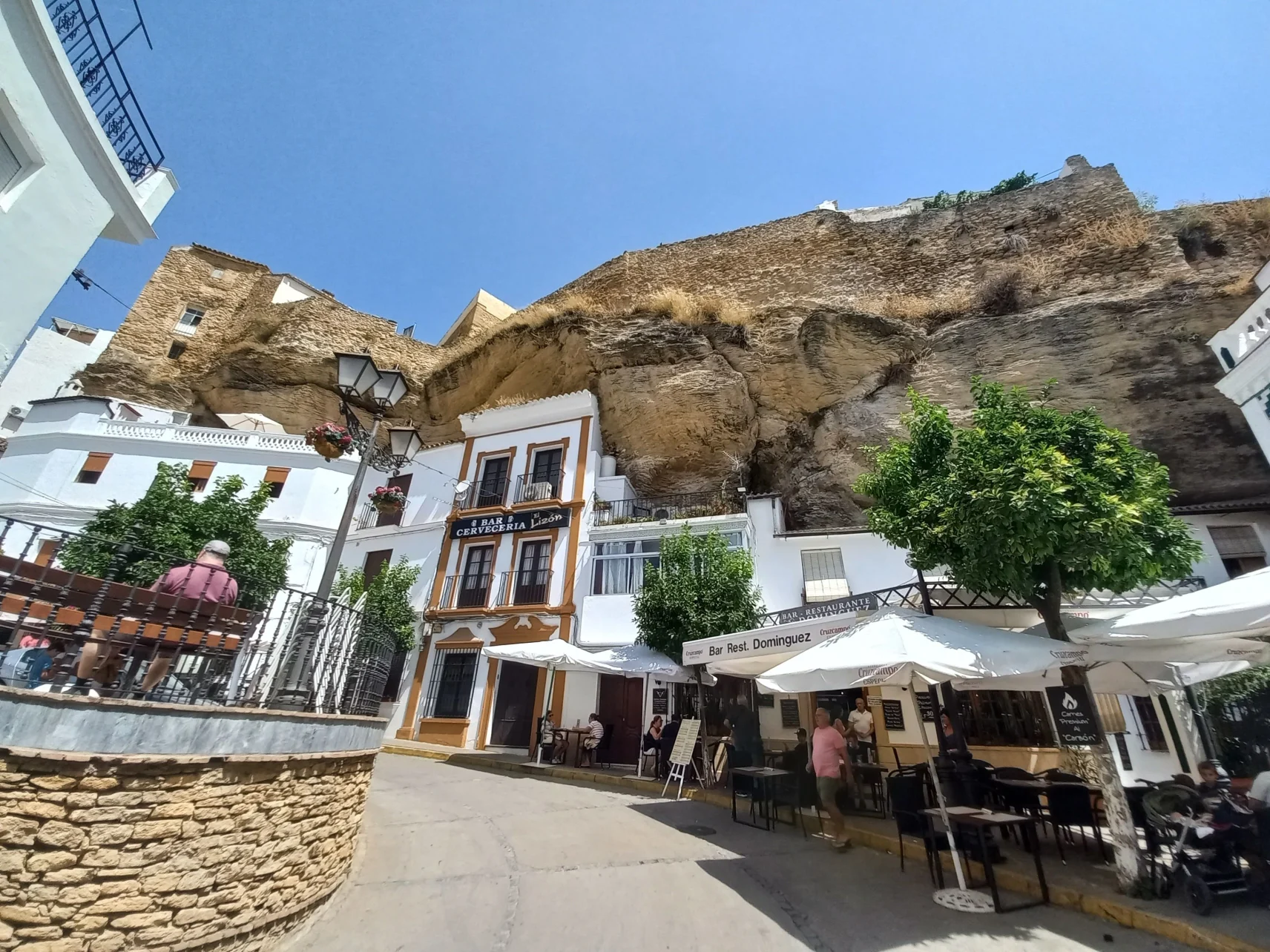
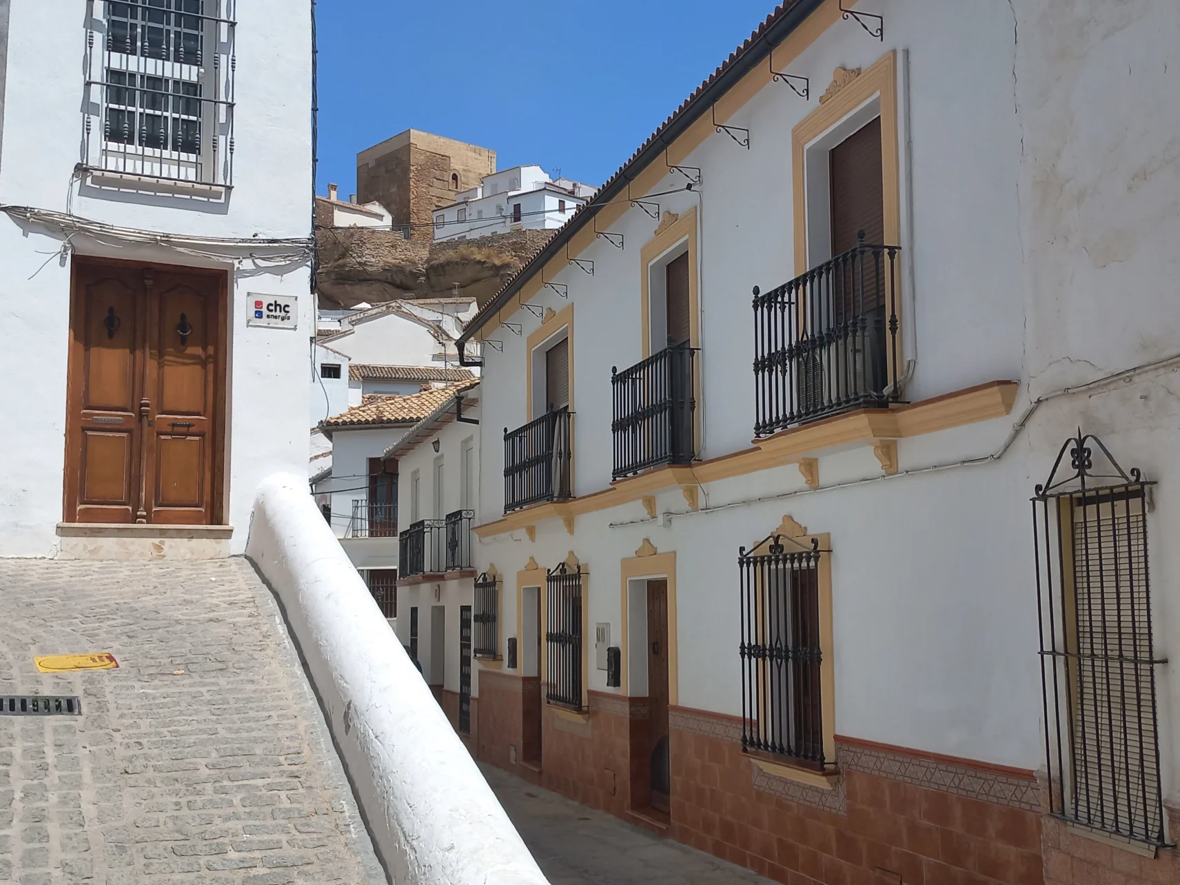
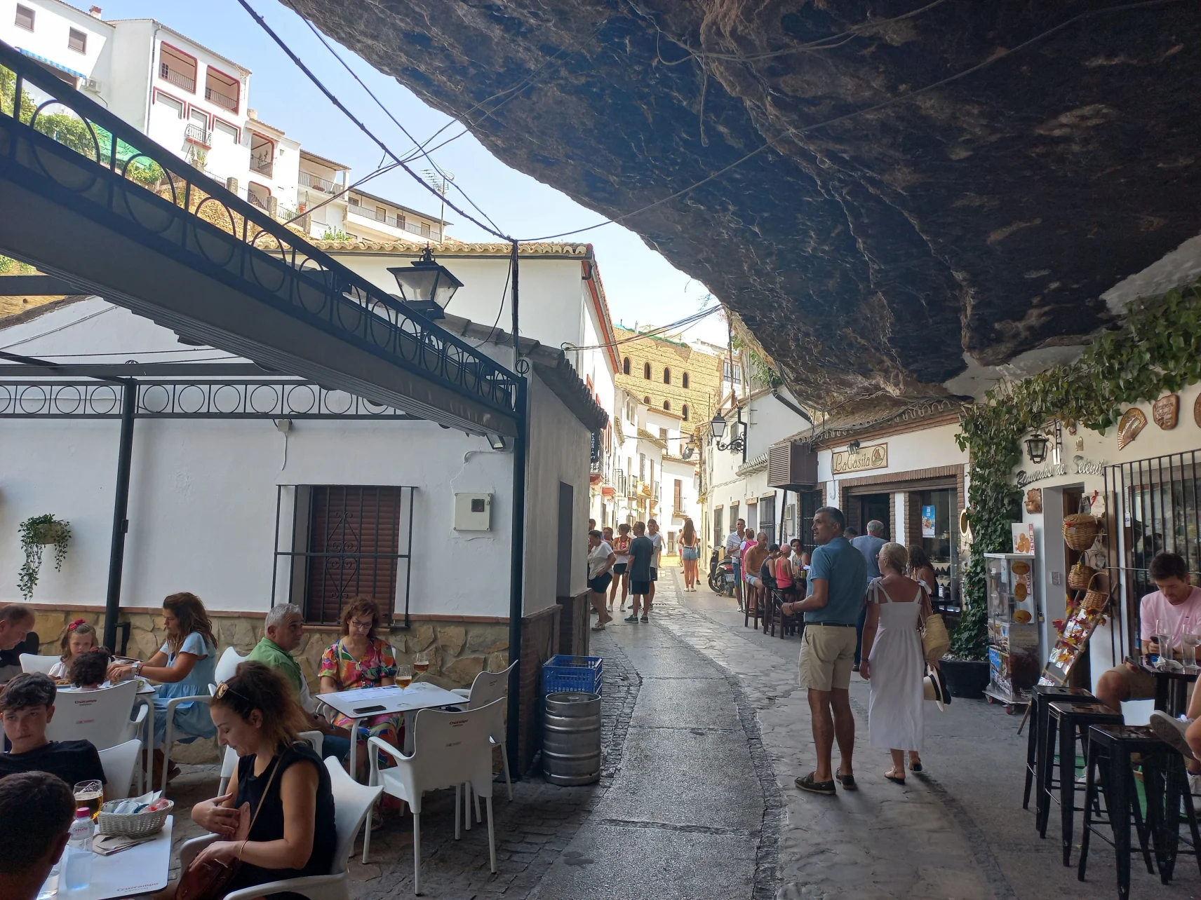
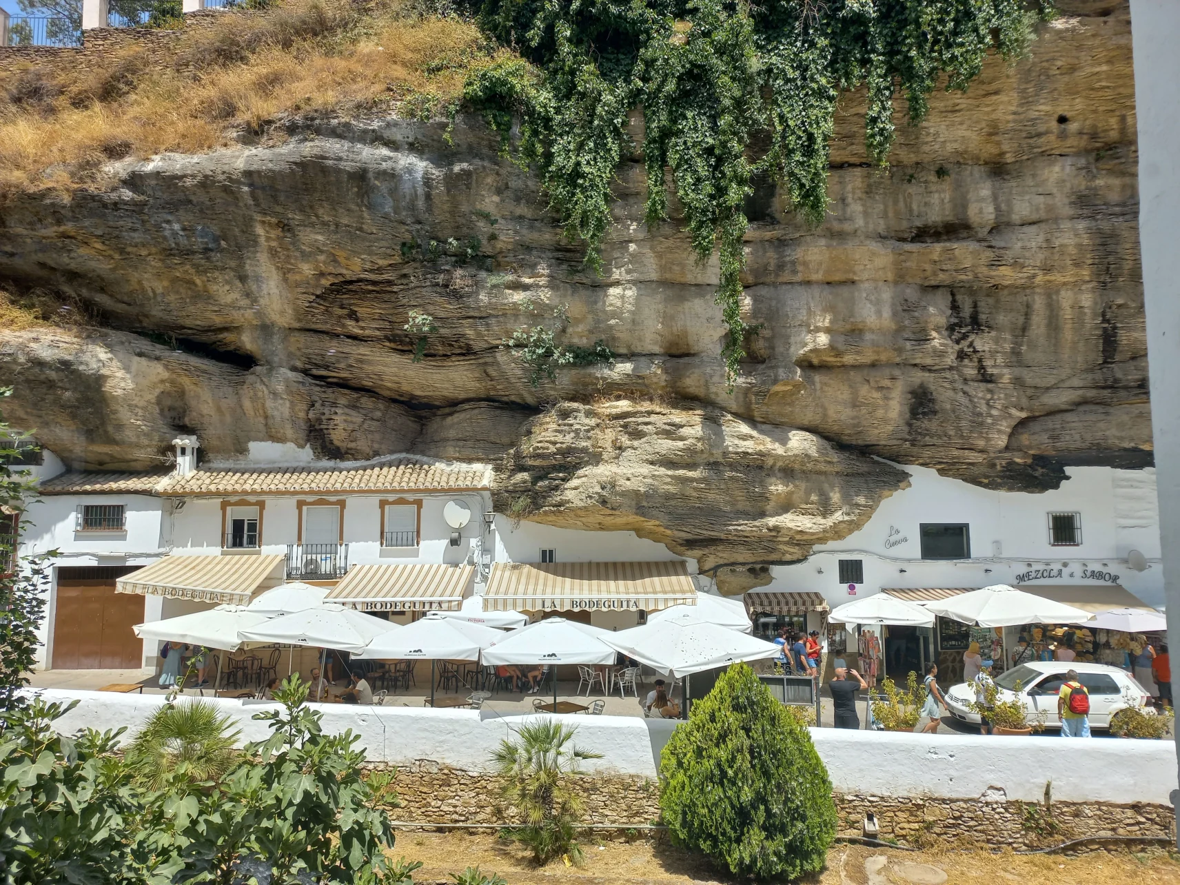
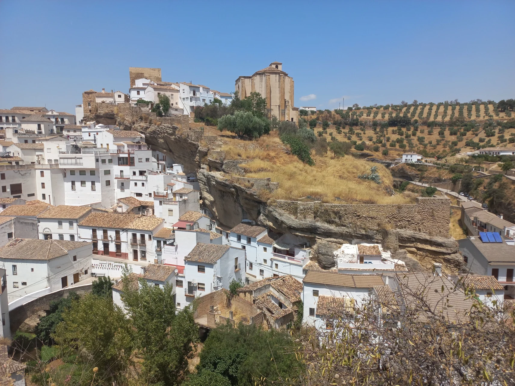
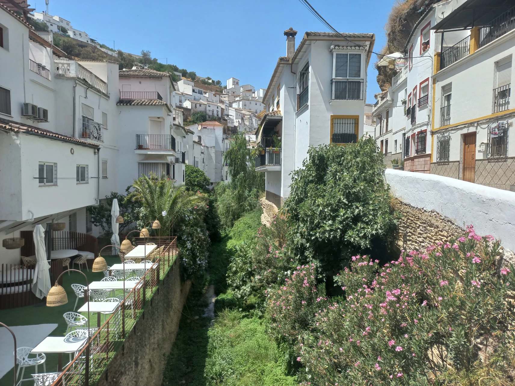
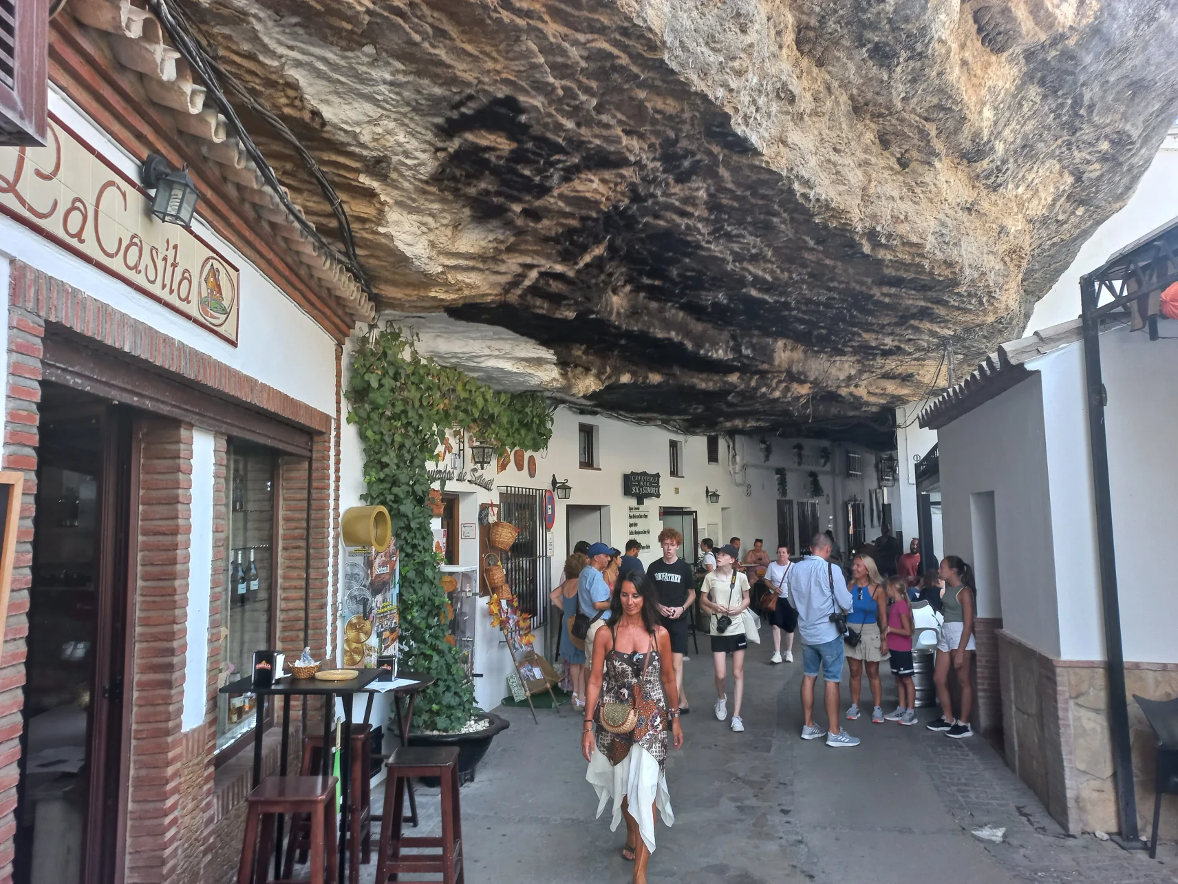
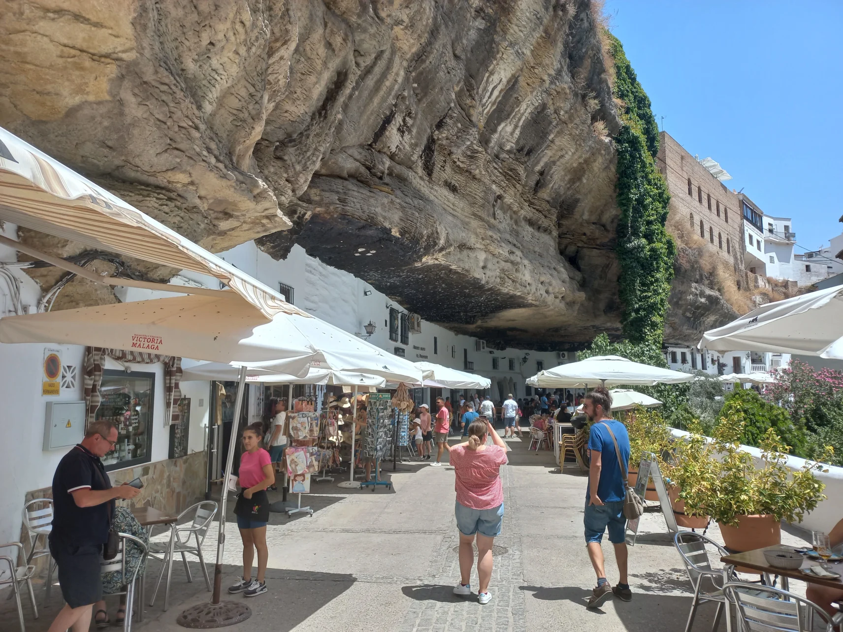
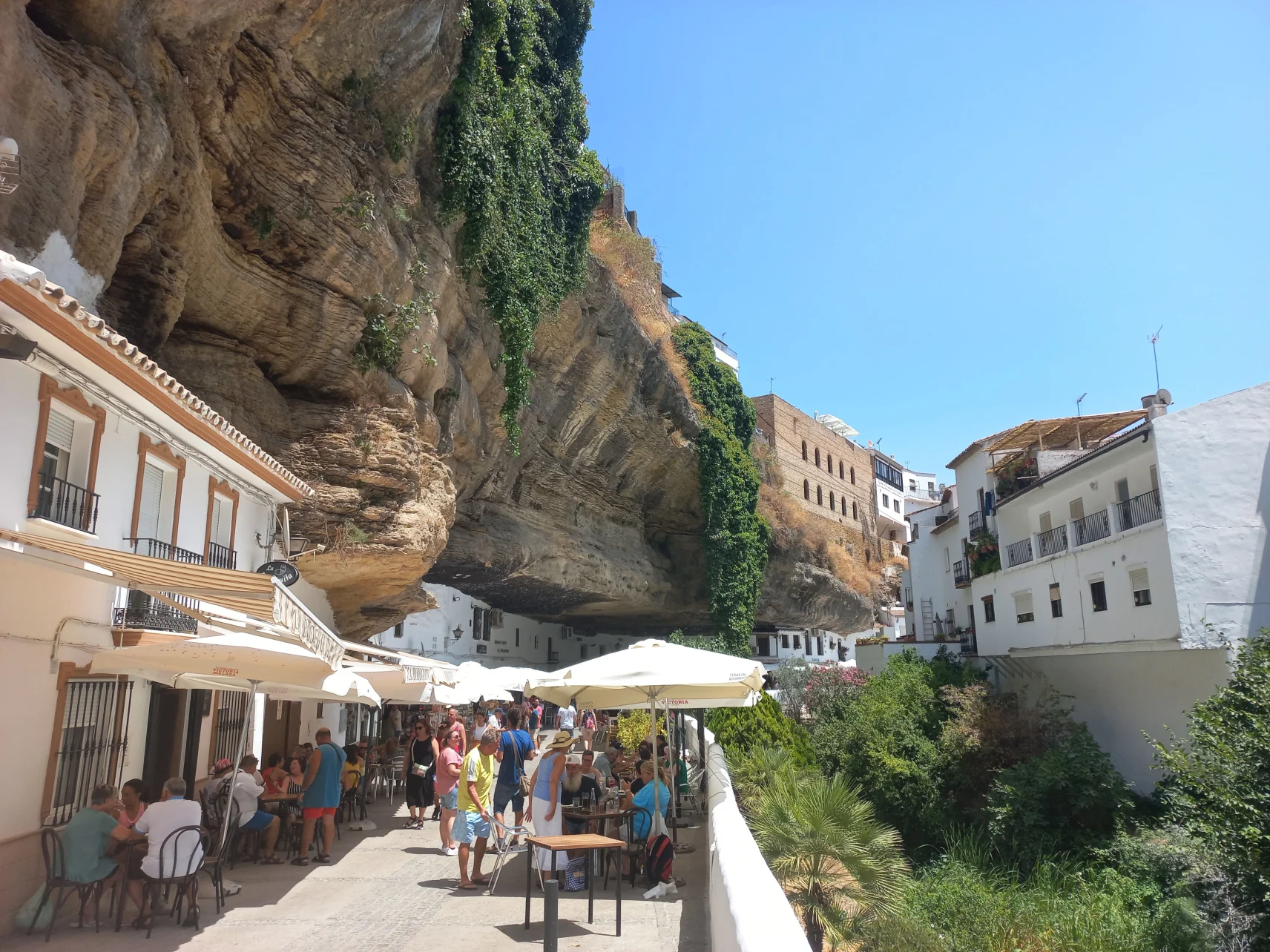
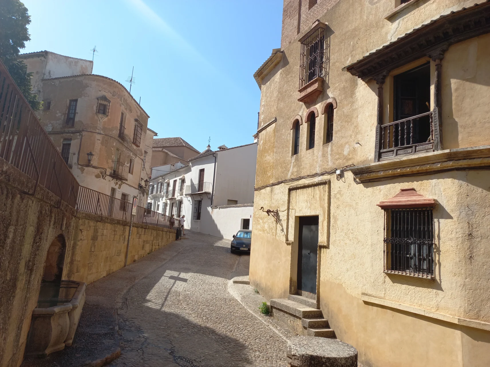
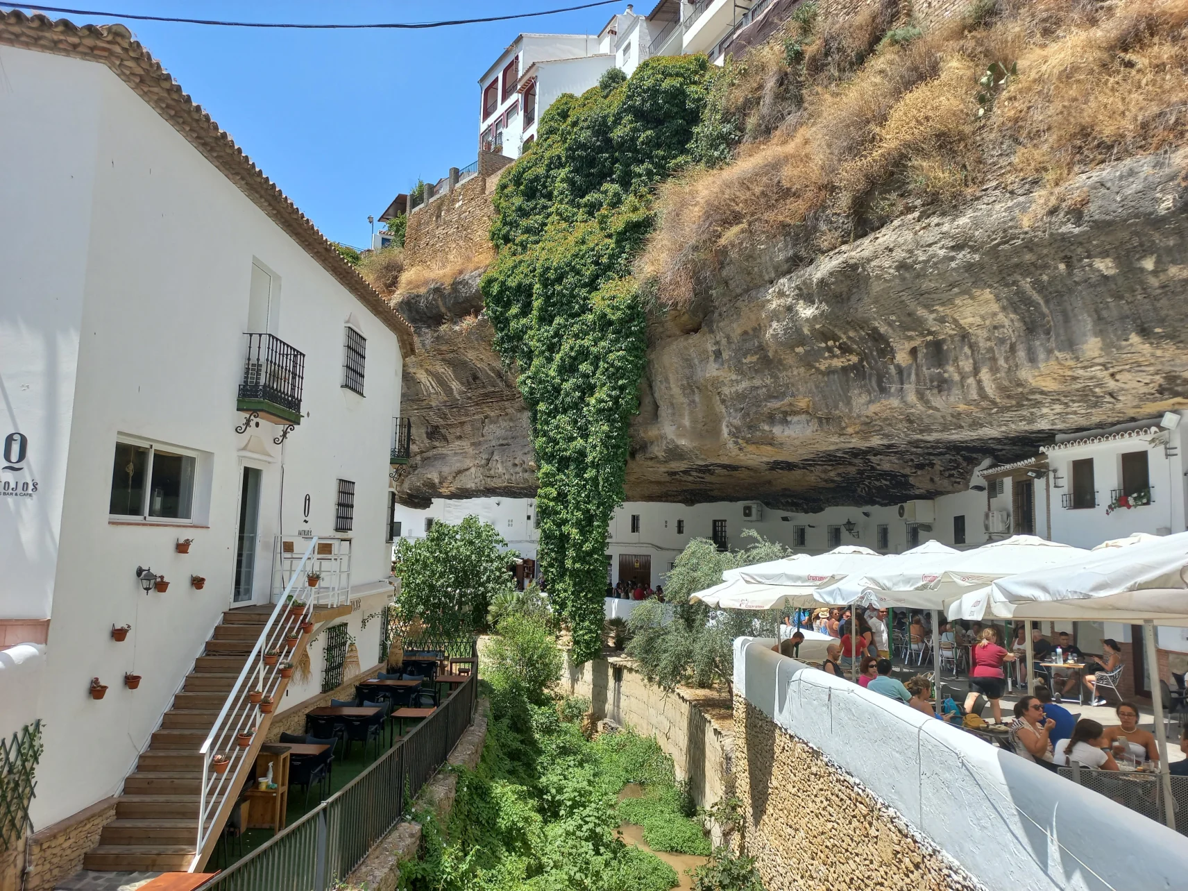
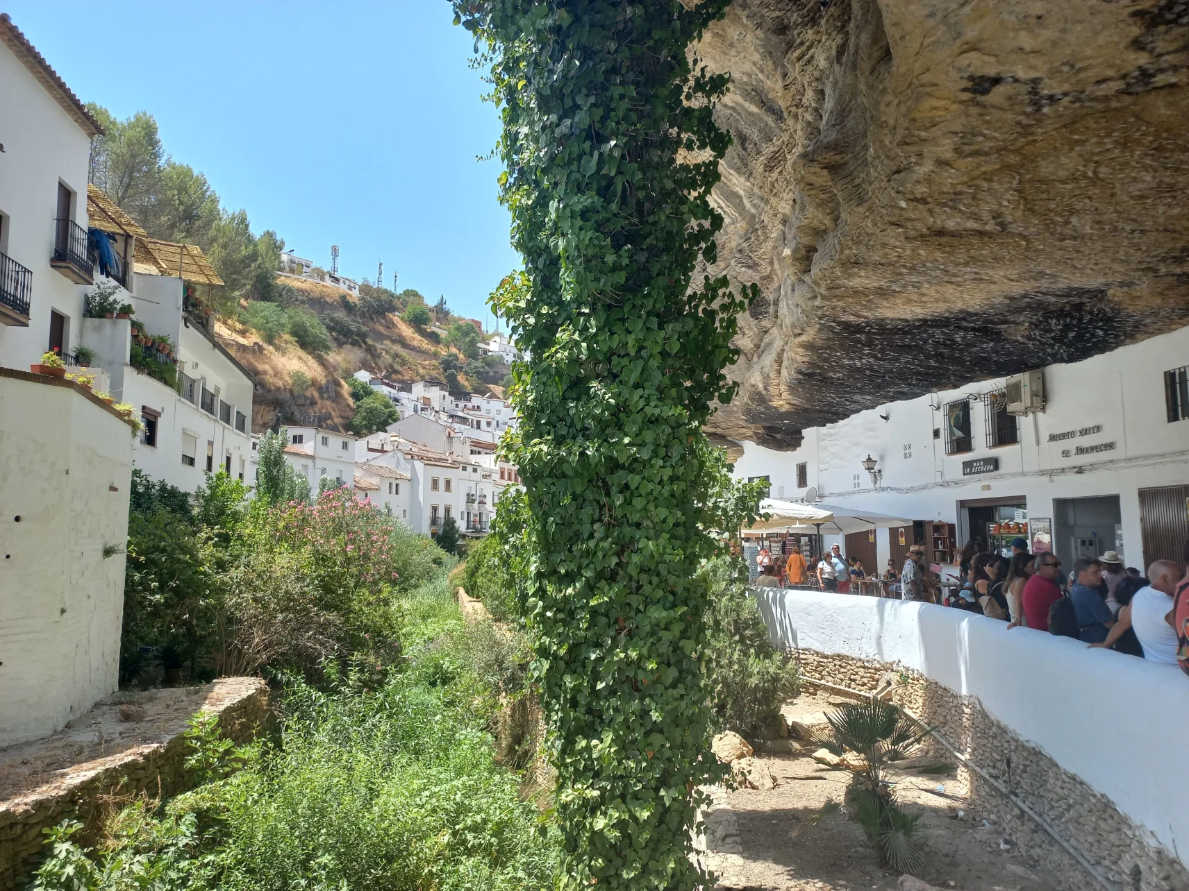
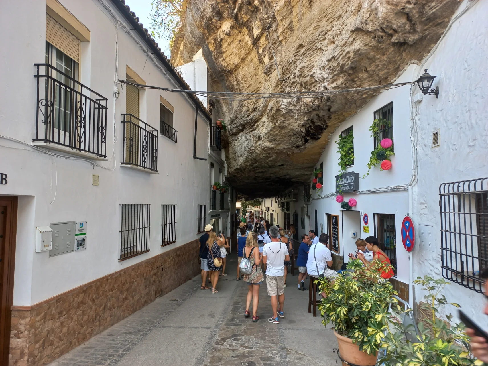
Setenil would have definitely scolded me if I didn't go there on a guided tour. Although I think I have my way around pretty well, even in places where I am for the first time, my compass kept getting confused in the town. The confusion came from the spatial planes sliding under and over each other. What I saw on the map as if two streets met, in reality were one street running at the top of a rock ledge and one at the bottom of it, with a difference of thirty to forty meters in level between them.
That is why it is easy to get lost in Setenil, even though the town is not big: the distance from one end of the old town to the other is some five hundred meters. Yet, those five hundred meters that can be drawn in a straight line on the map, must be covered on the terrain through winding streets, and the total length of the walk can be three times that. In the town there are no straight streets: everything gently bends and confuses. However, this confusion is a pleasant feeling, a strange mental state, which for me was the most interesting experience of the town.
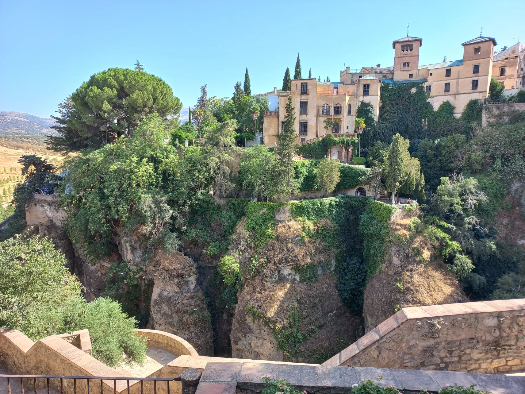
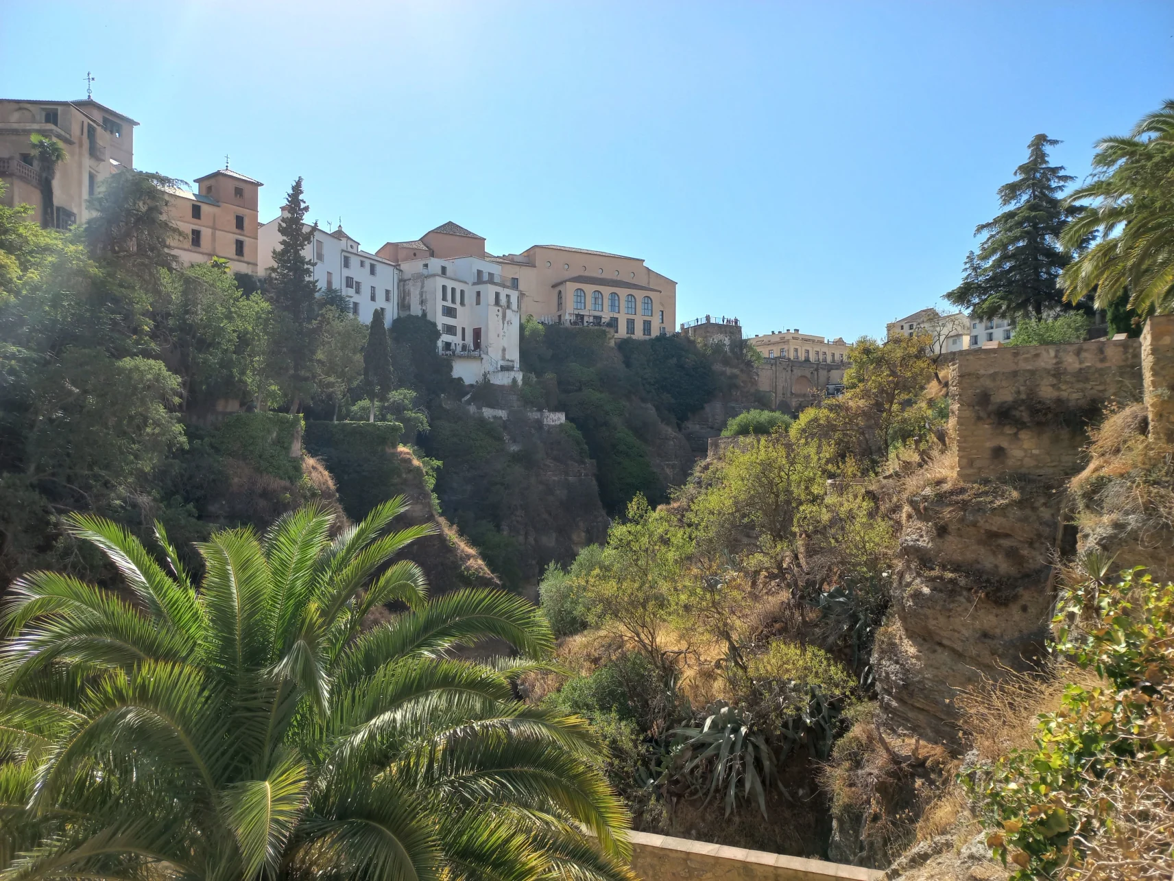
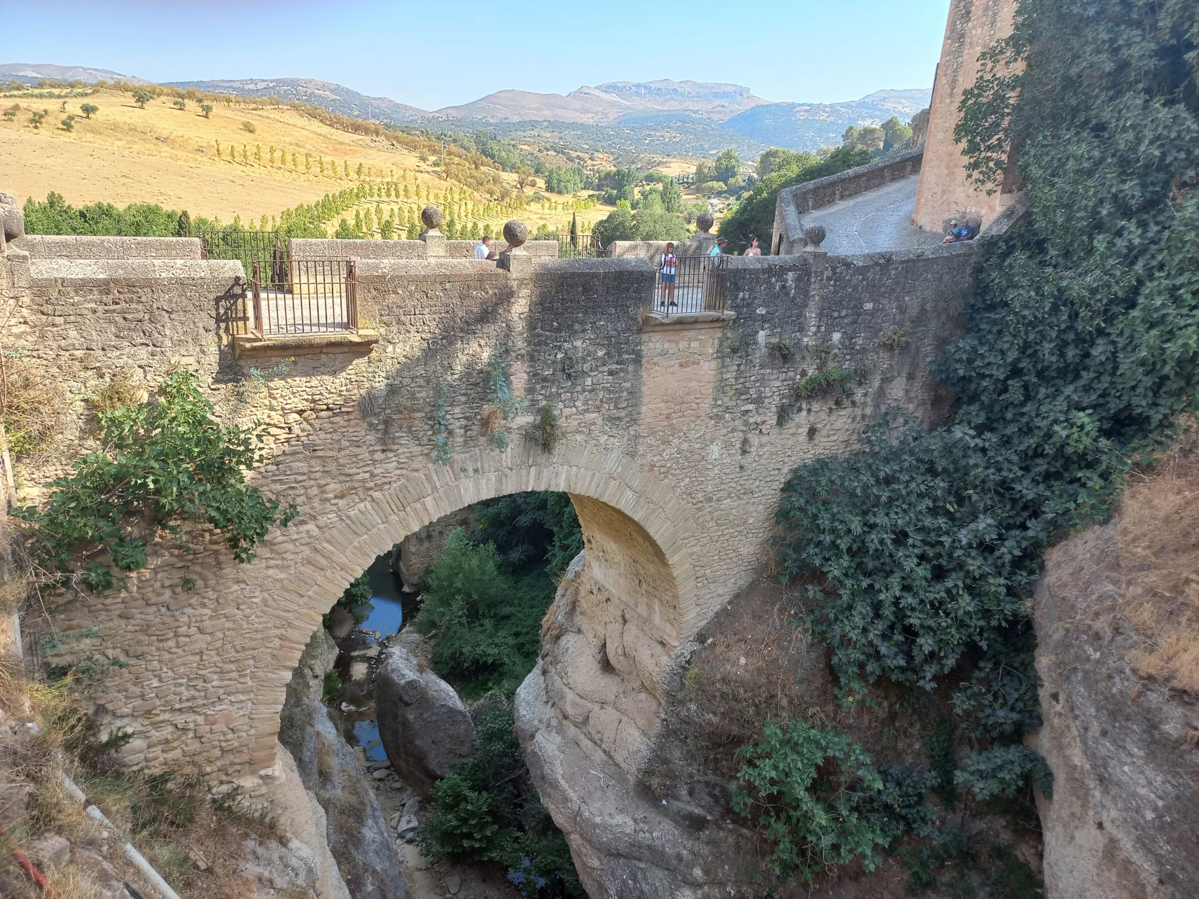
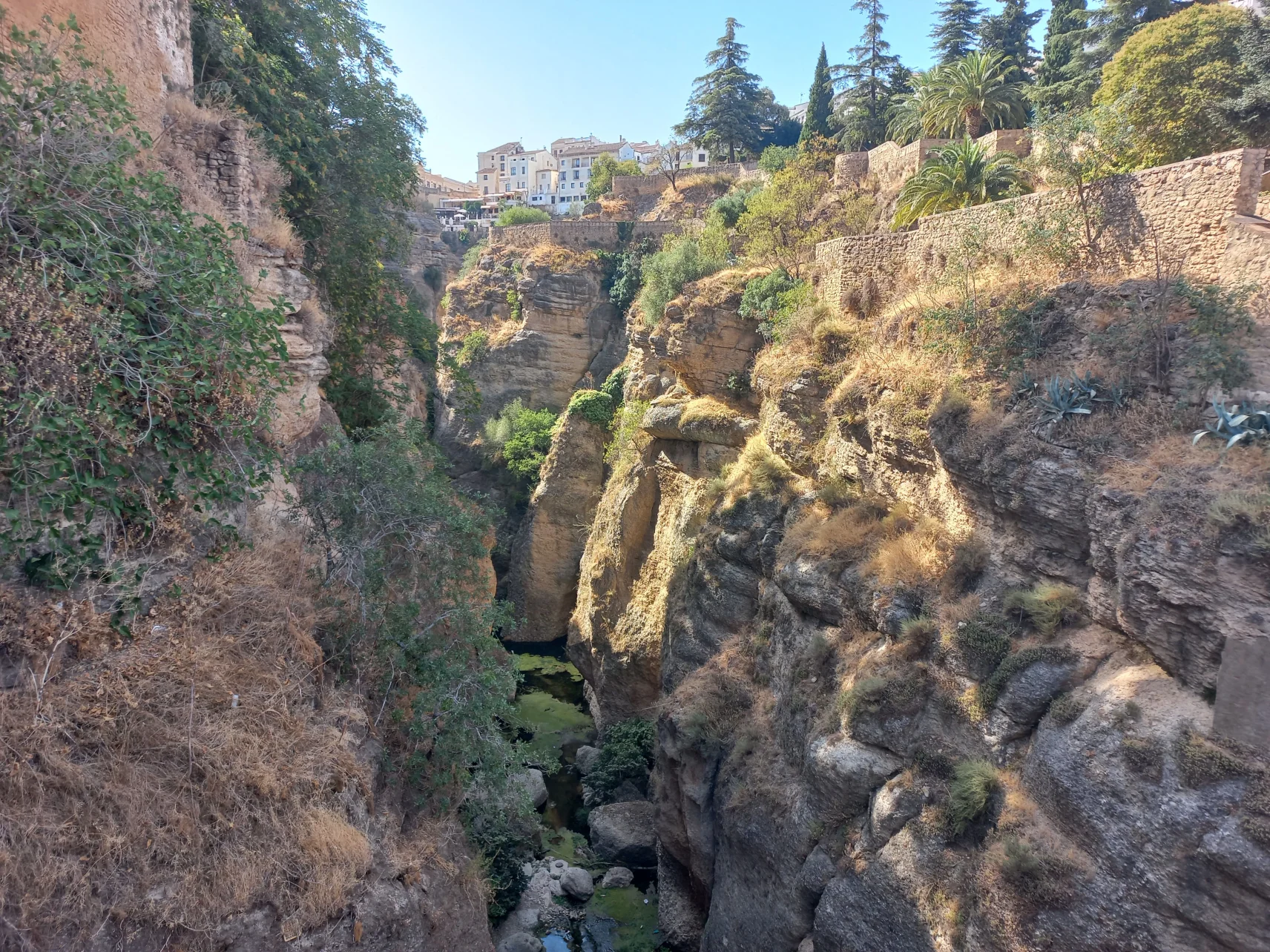
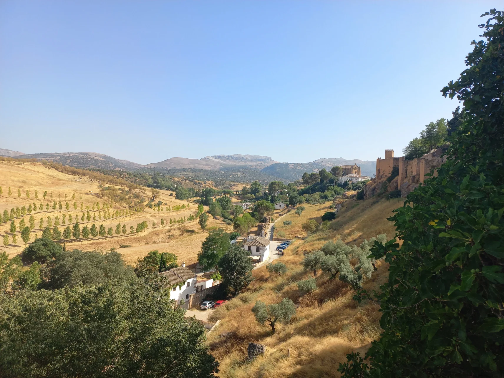
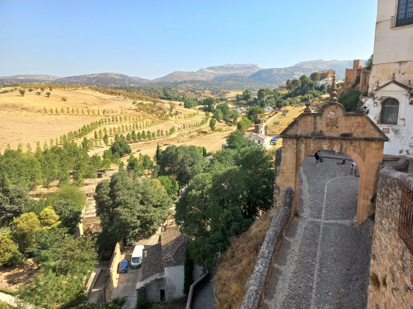
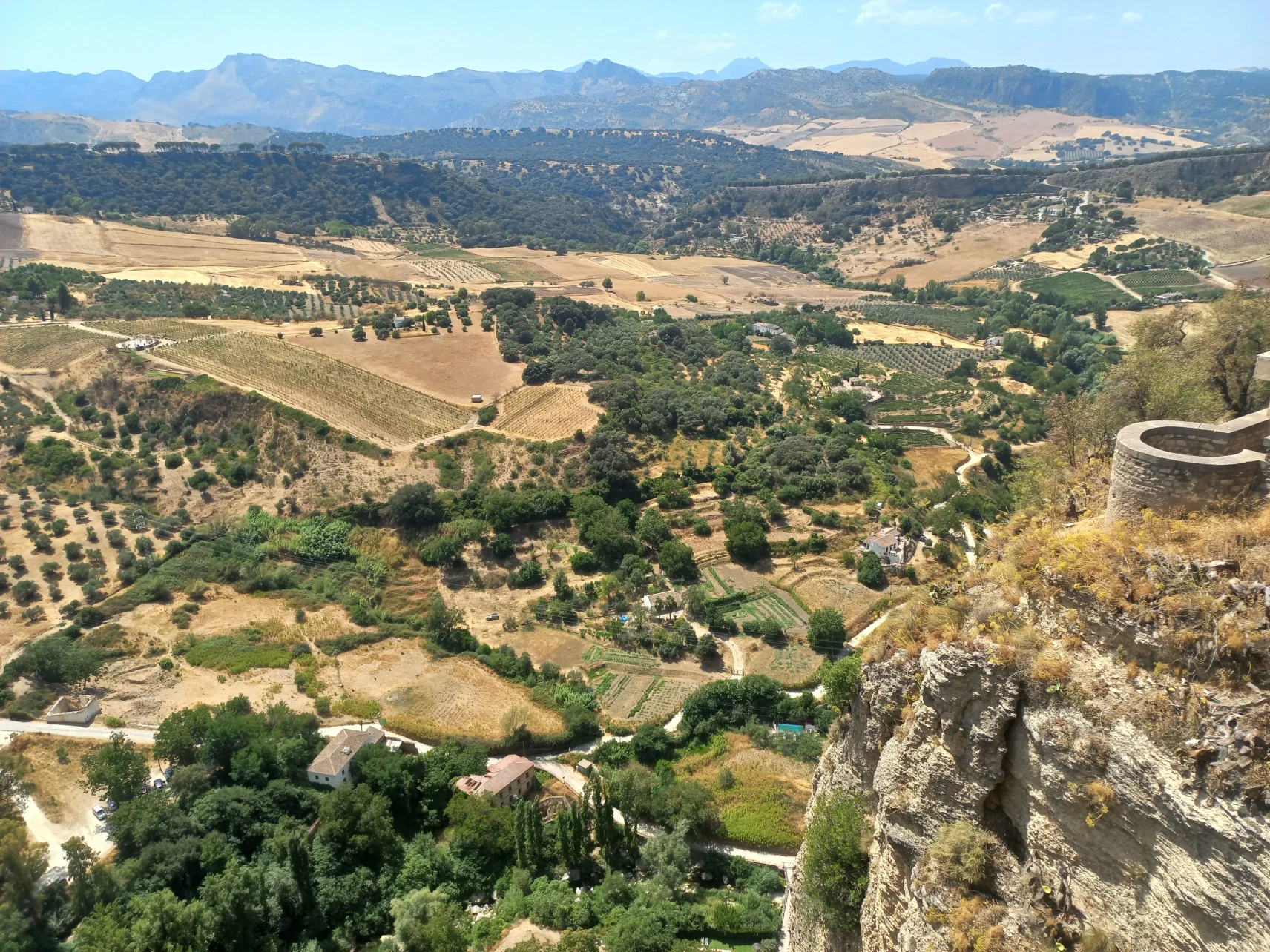
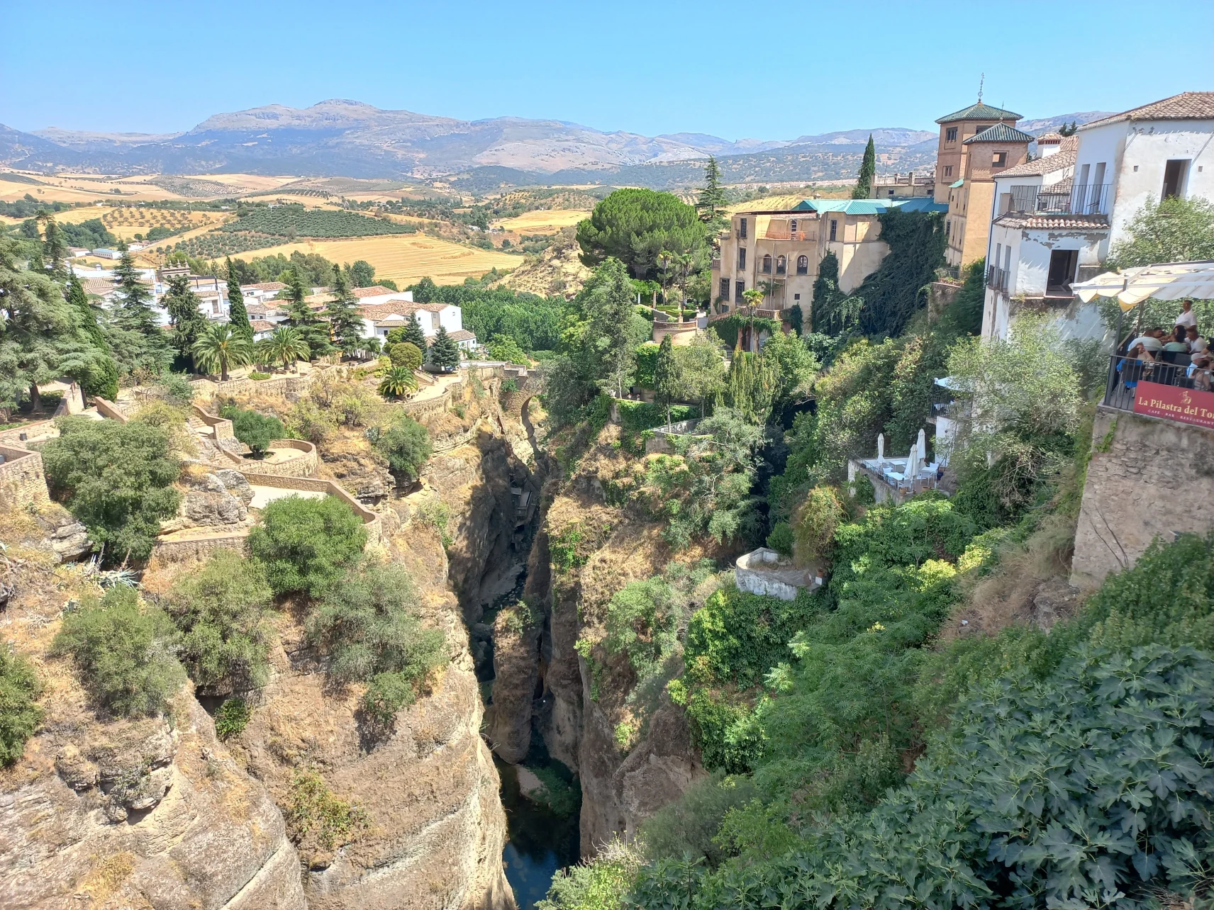
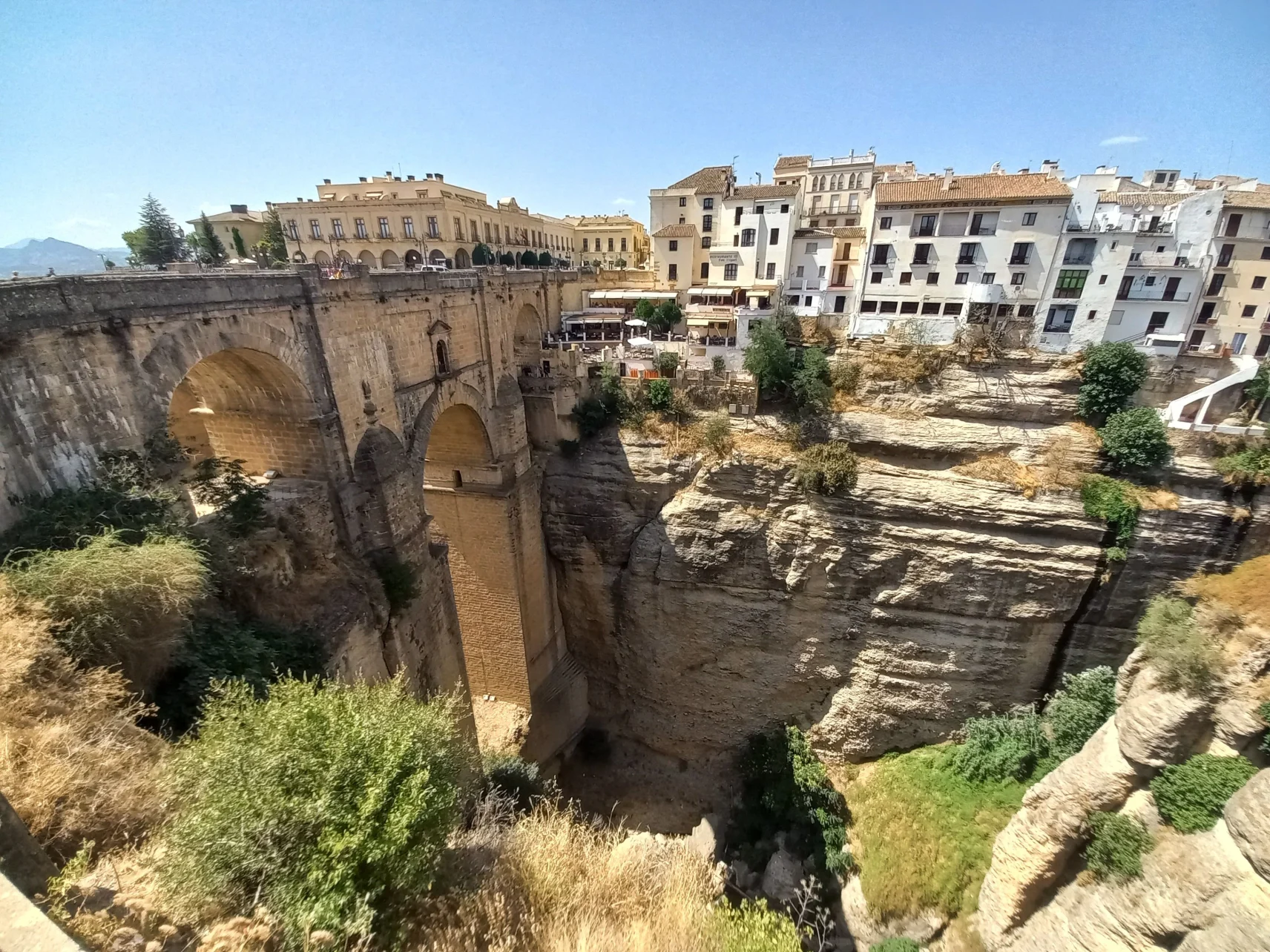
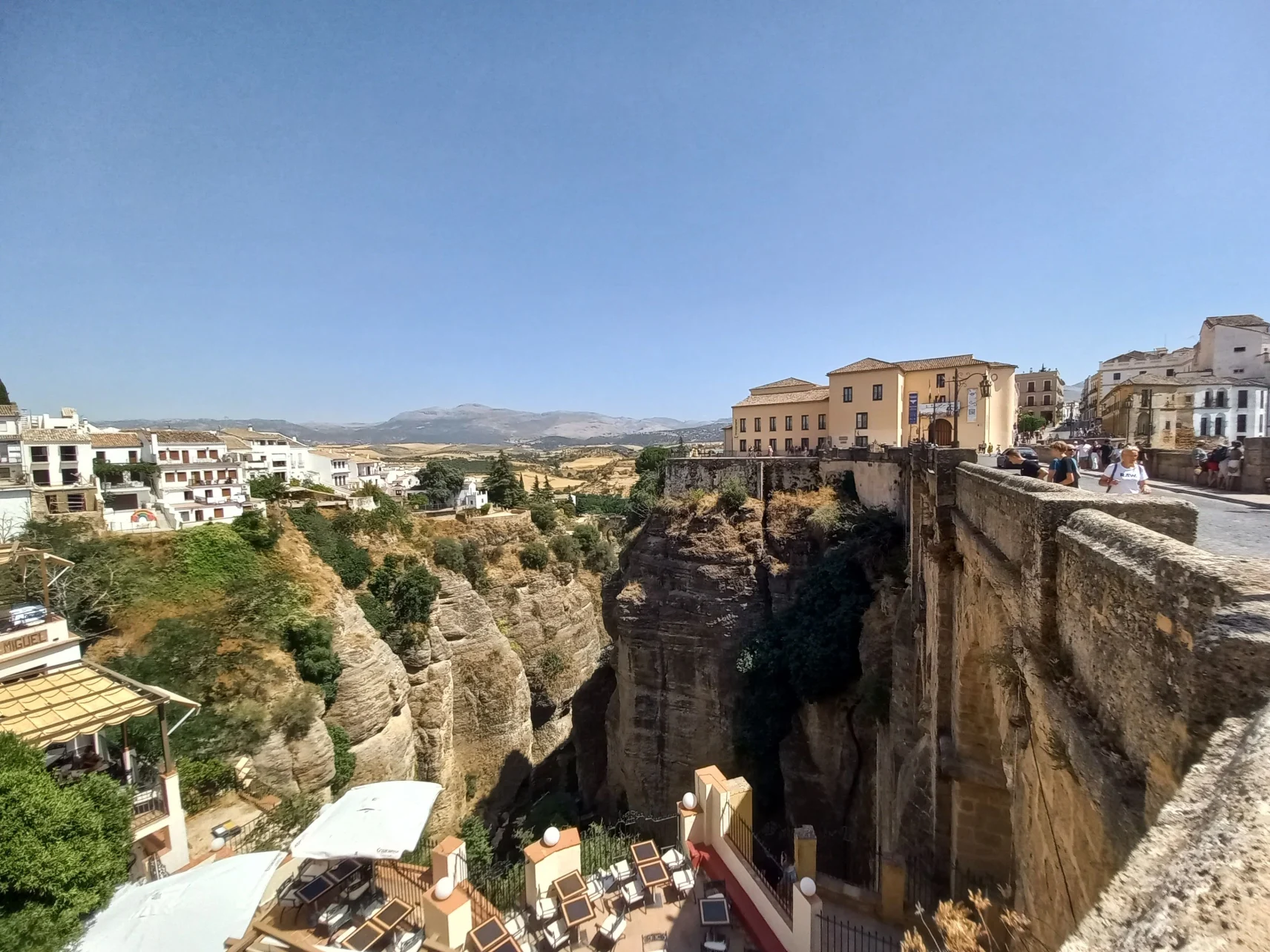
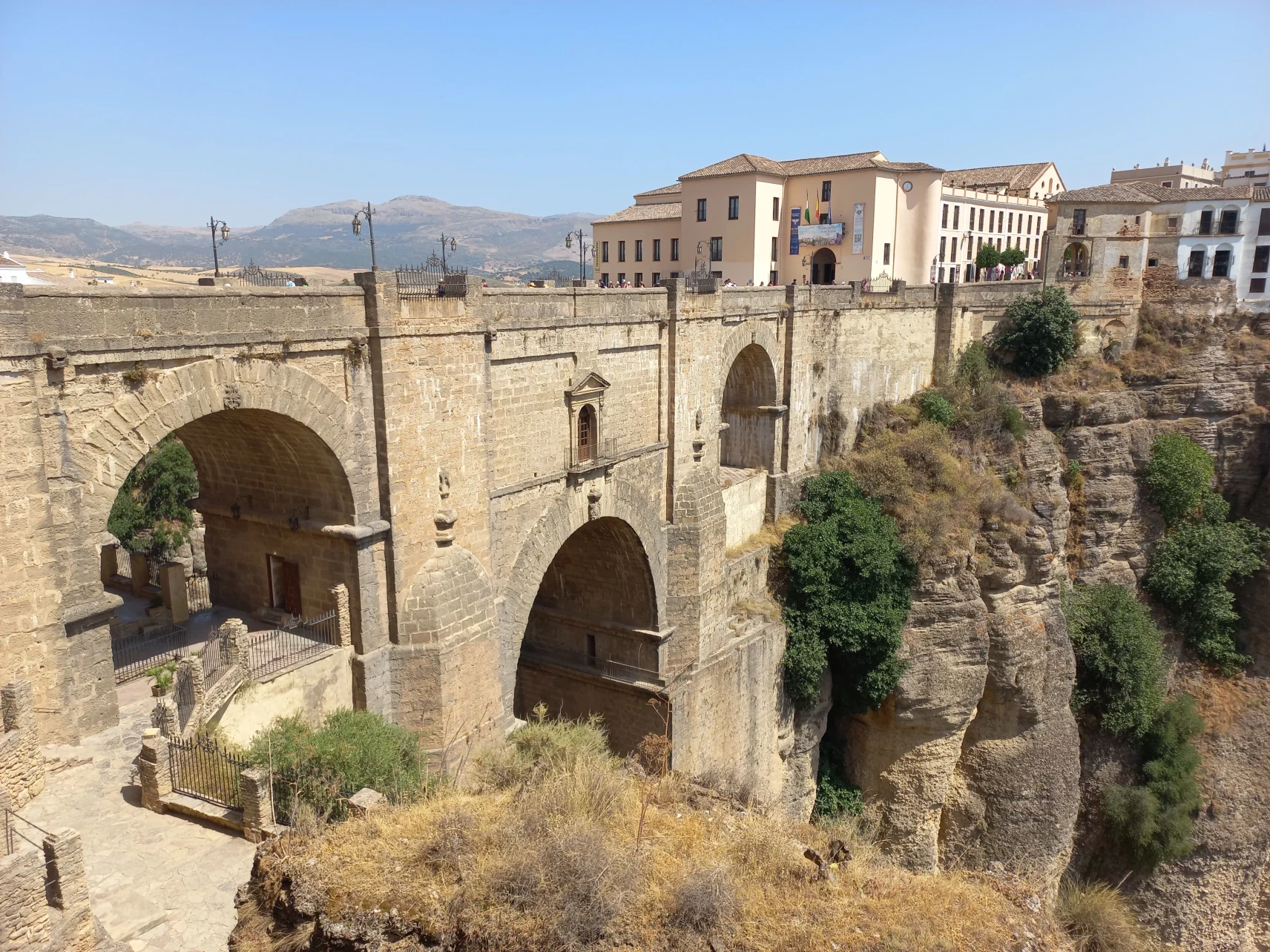
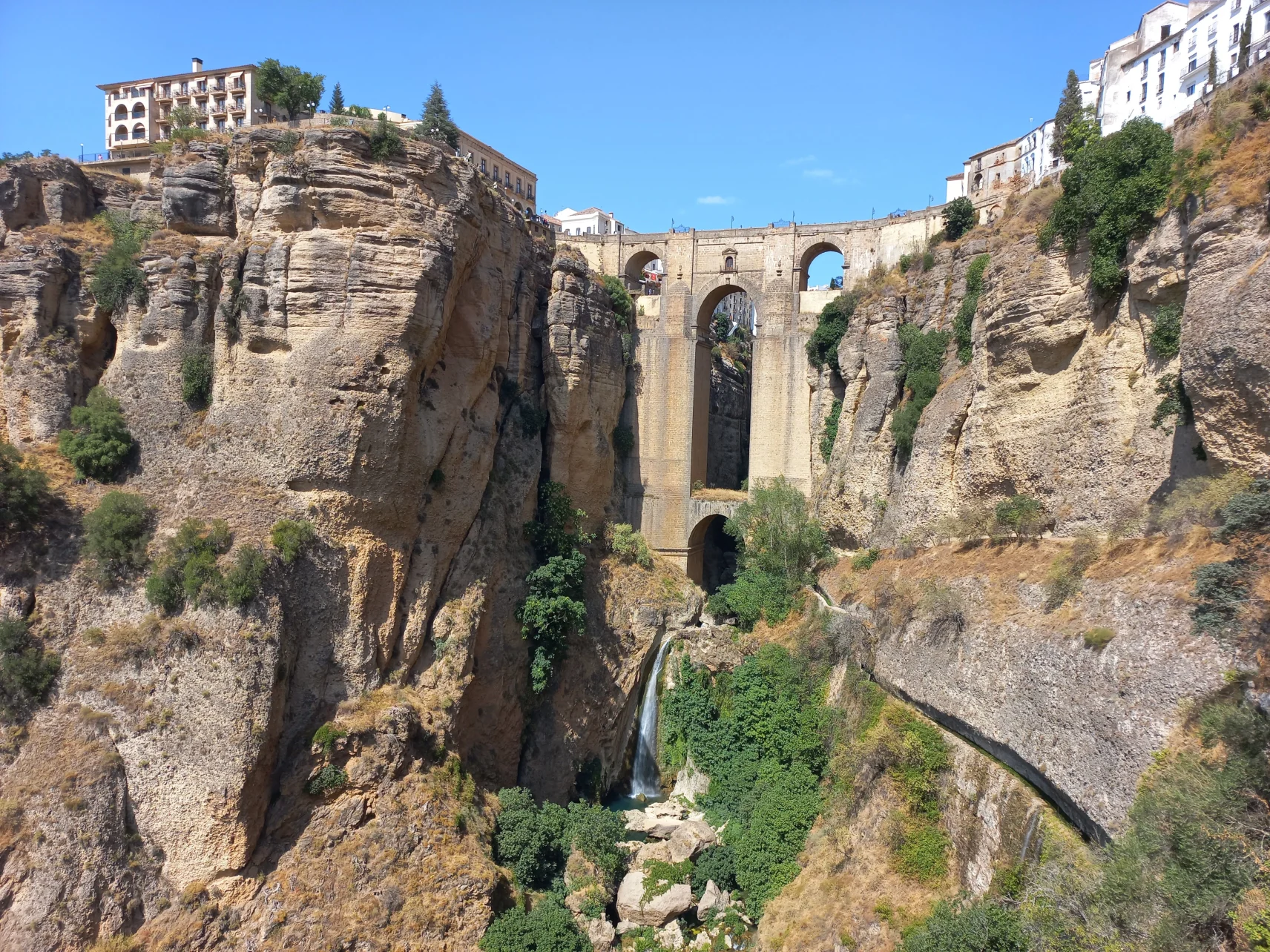
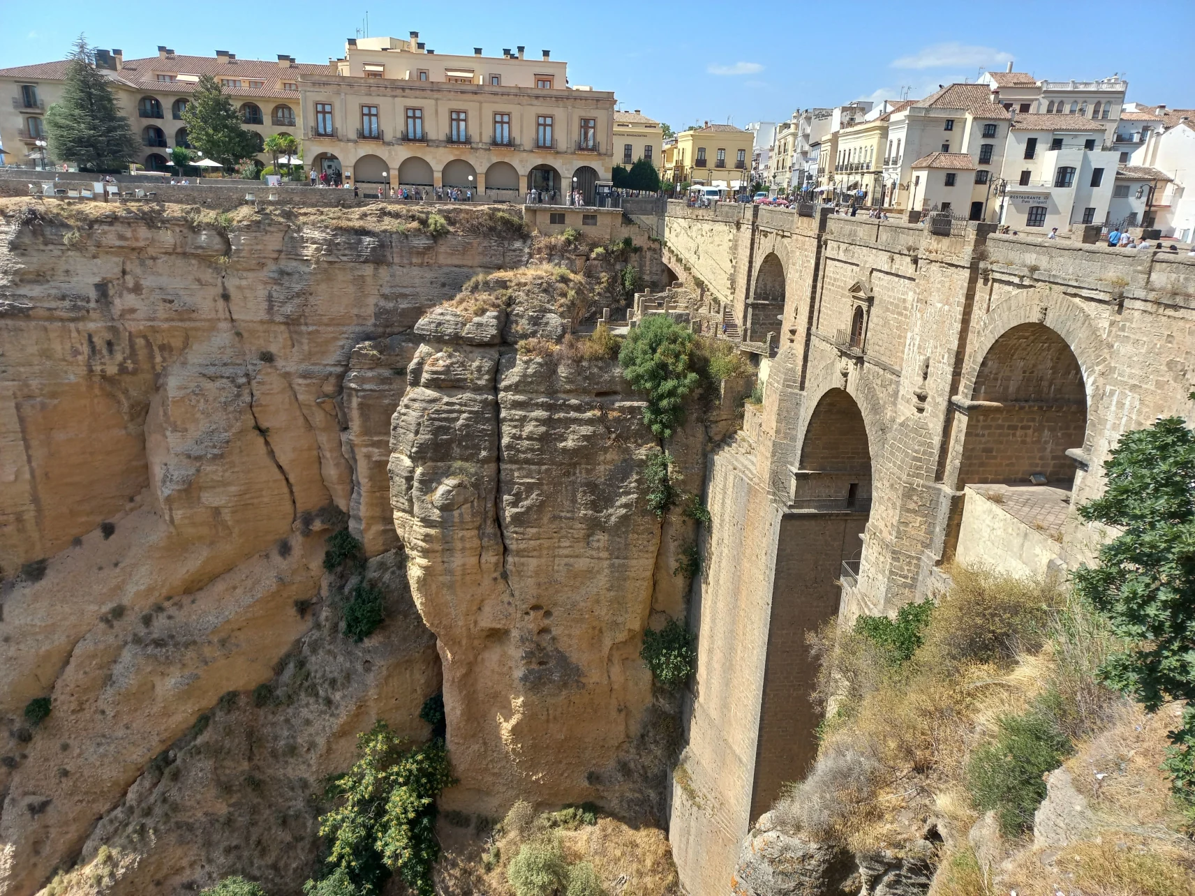
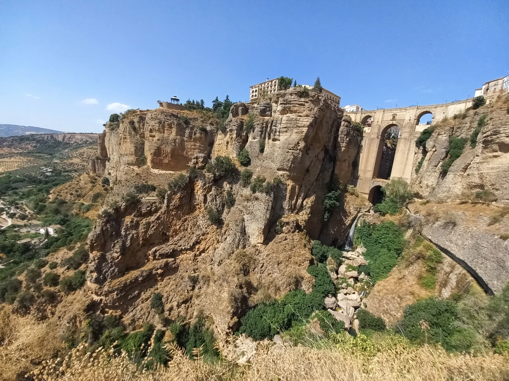
Our second destination for the day was Ronda. My wife and I could not help but constantly entertain each other with word jokes: the word “ronda” in Hungarian, our mother tongue, means “ugly”. Needless to say, Ronda is not ugly at all: it is one of the most beautiful towns in Andalusia. As anyone who has been there or at least seen a picture of this strange place can testify: Ronda looks as if it had been torn in the middle. The plateau that supports the city offers a beautiful view of the surrounding plain, but its real specialty is not this, but the hundred-meter-deep gorge that separates the old town from the new town, and which is bridged by the massive Puente Nuevo bridge, built in the 18th century.
It was a surprise when we reached the edge of the precipice. From above, you can't really see how huge the bridge connecting the two parts of the city is, so we headed down into the gorge to find the best photo spot. Where most of the tourists stopped, Manu pointed to a small path: “let's go further down”, he said. And indeed, after another two minutes of descent, we were in a slightly secluded, weedy place, from which the whole of the Puente Nuevo could be seen, from the brook gurgling in the depths to the top of the bridge, on which the passers-by seemed quite small. It was difficult to fit it into the photo frames, as the height of the bridge was so imposing from that angle.
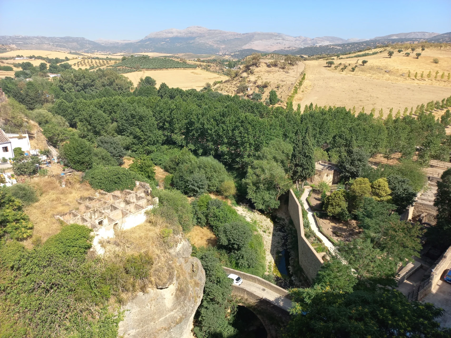
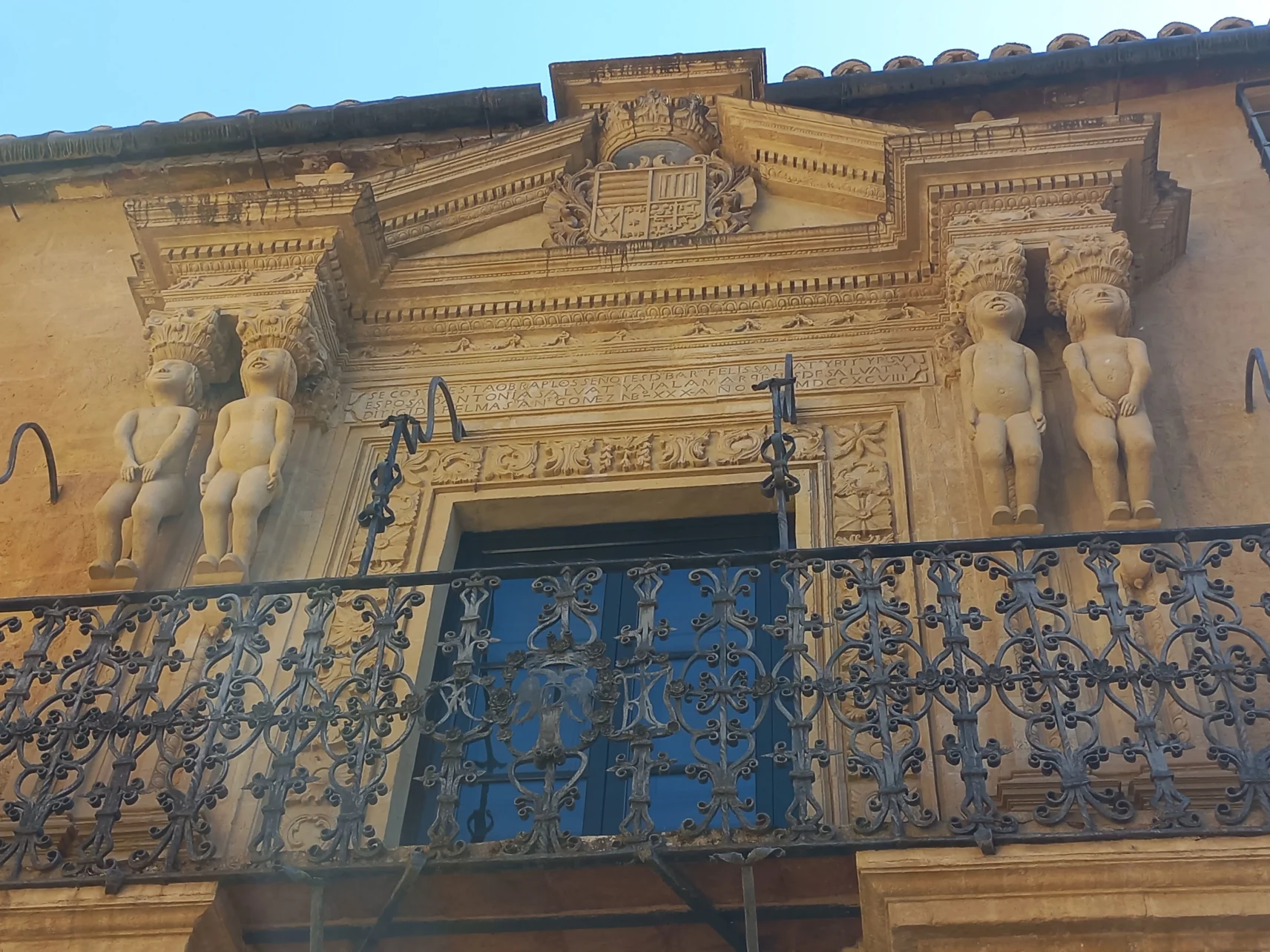
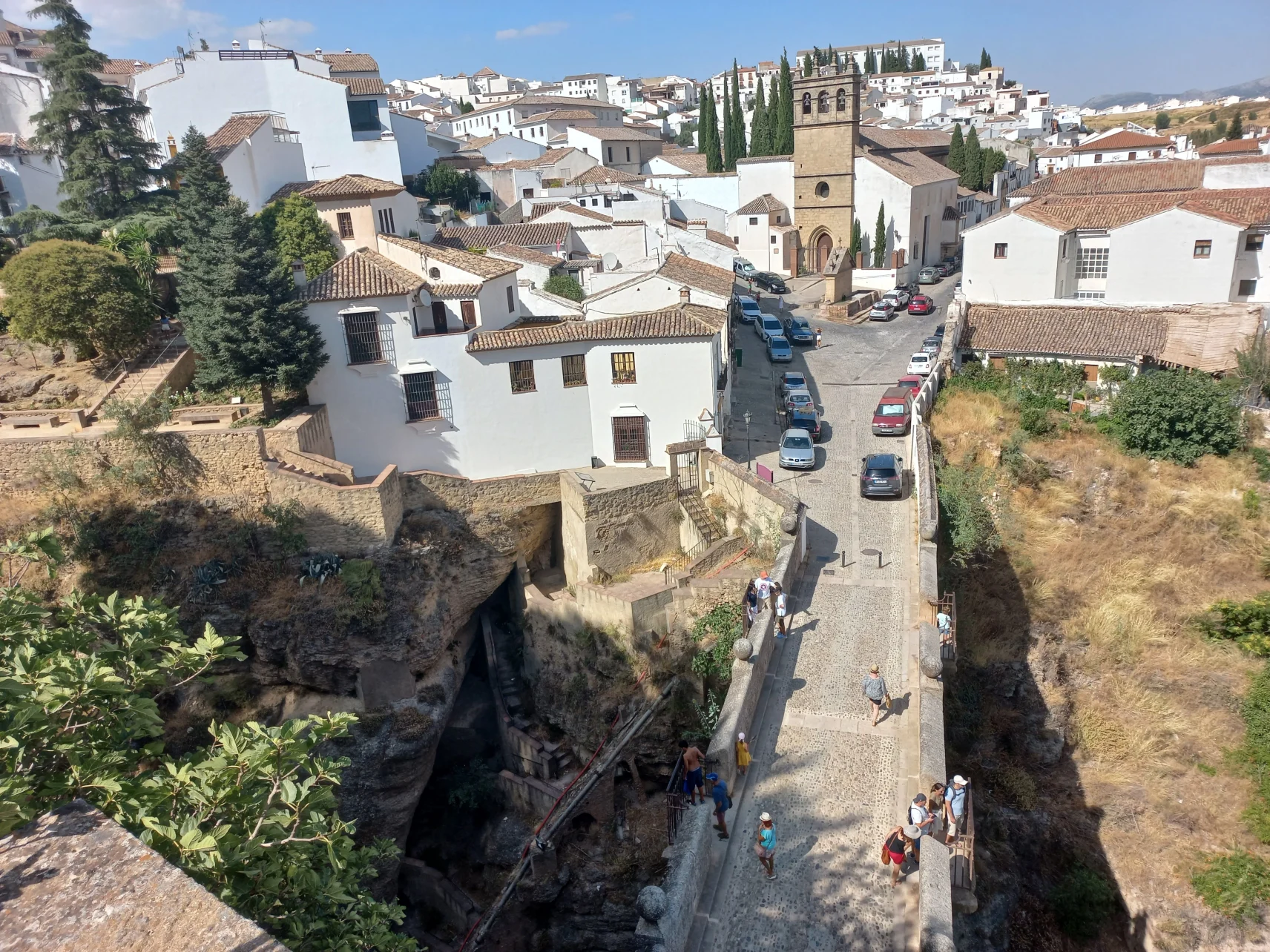
For the rest of our sightseeing, we explored Ronda's three-dimensional spaces even more. We climbed back between the houses, but only to start descending again a few corners away. Passing the Palacio de Salvatierra, we got down to the Puente Viejo spanning the chasm. Here we were much deeper than the level of the town, but the water of the stream still flowed at a considerable depth below us. By the way, this was the level at which the fields around the city were spread out, and as we got down, we were practically out of the city: olive trees stretched to our right. From here we climbed back up to the level of the city and in the meantime, we fancied how imposing the palaces built on the edge of the gorge look from this angle.
After all that walking up and down, it was of course very nice to sit in the air-conditioned van and rest a bit on the one-and-a-half-hour drive to Málaga. The road between the olive trees, barren mountain peaks and small, snow-white villages was flat, and this flatness felt so good. After visiting the cities that wished for three-dimensional maps, it was a good feeling to return to the reality in which the roads running on the map do not curve under and over each other.
- Author: Béla Soltész
- Pictures: Anazu Design